 Where is Holguin
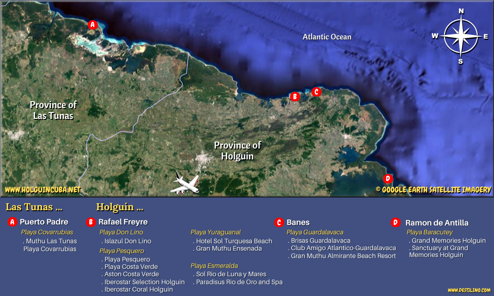
Holguin is part of the Cuban “Oriente” or east. It lies in the southeast of the country and is the third most populous province after Havana and Santiago de Cuba. It includes 14 municipalities in which are located 1112 agglomerations, including 43 urban. Its capital, also named Holguin, is the fourth largest city in Cuba. Holguin is bordered to the east by the Guantanamo province, to the west by the Las Tunas province, to the south by the Granma and Santiago de Cuba provinces, and to the north by the Atlantic ocean.
The province of Holguin has a privileged geographical situation with 350 km of coastline dotted with beautiful bays and beaches. It's on the coastal area between the municipalities of Rafael Freyre and Banes where we can find the most popular seaside resorts of Holguin. Beaches in this area include: Playa Guardalavaca, Playa Esmeralda, Playa Yuraguanal (aka Playa Turquesa), Playa Pesquero and Playa Blanca. The beautiful Bahia de Naranjo (Orange Bay) can also be found in this area (between Playa Esmeralda and Yuraguanal).
See the interactive map at the bottom of this page
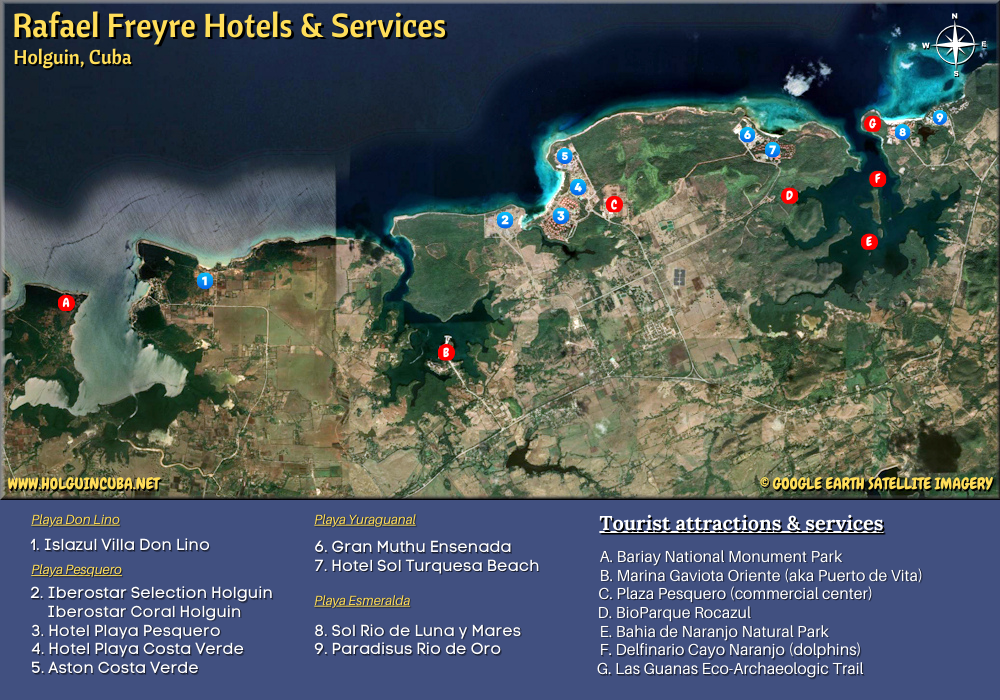
Click the following links to view an aerial image showing:
The location of the all-inclusive resorts
The location of tourist attractions and services
The Holguin International airport,named Aeropuerto Internacional Frank Pais (IATA code: HOG) is a small-size airport located 13 km southwest of Holguin city. It serves Holguin's popular seaside resorts near Guardalavaca and Rafael Freyre, but also many other eastern regions of Cuba, such as Cayo Saetia, Mayari, Gibara, Las Tunas province, Puerto Padre, Playa Covarrubias, Bayamo, etc.
Holguin province:
Foundation: 1545
Area: 9293 km2
Population (2015) : 1,0437,572
Density : 112 inhab. / km2
Time zone: UTC-5 (EST)
© Google Earth. Click or move your mouse pointer over the markers to view description. Click & Drag to change map area and see other points of interest in the region. Zoom in or out using the + and - buttons or your mouse's wheel.
Lily & Normand
© holguincuba.net
© destilino.com